Real Estate
Putnam County court records, Oct. 26-Nov. 6
By Ronald T. Jennings
Advertisement · Why this ad?
Angela M. Rodriguez is a Lima native and has been covering community stories for over a decade. She graduated from Miami University and has previously reported for WYSO, focusing on local social issues and community events. Her ability to connect with residents makes her stories resonate deeply.
More from Angela →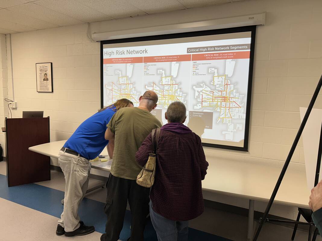
News Top Stories Facebook X Pinterest WhatsApp LIMA — When it comes to keeping Lima roads safe, city officials may be more equipped than ever before to deliver targeted relief to the everyday dangers residents face. The city took public feedback Tuesday at the Bradfield Community Center on its Comprehensive Multimodal Safety Action Plan, which aims to guide future safety investments in corridors with the most risk and occurrences of serious traffic accidents. Public comment will be accepted now through Dec. 10 via tinyurl.com/bdd542kv , which is also where the plan’s three draft analyses are open for review. Residents can also voice concerns during a virtual open house from 6 to 7 p.m. Wednesday, Dec. 2 on Microsoft Teams at bit.ly/4jDvZFU . The plan, developed using $485,560 in federal grant funding, was first announced Sept. 30 and showcased a map of the city’s “High Injury Network.” The analysis compiled crash data from 2016 to 2025 to determine areas with the highest density and most severe outcomes of crashes, with the top three segments being on North Cable Road between Allentown Road and College Park West. Monday’s open house, however, also featured a “High Risk Network,” which established areas where crashes are more likely to occur based on features such as being close to a school or park, having speed limits over 30 mph hour and carrying a lot of through traffic. Tom Flask, transportation engineer and consultant for the city through LJB Engineering, mentioned how those factors can play a big role in traffic safety. “In particular, higher speeds, like every five miles an hour faster, exponentially increases the risk of it being an injury crash versus a property-damage-only crash,” Flask said. “… When you end up with busy streets, we’re calling them 10,000 vehicles or more (per day), you increase your exposure to crashes a lot.” Flask noted the importance of community feedback in factoring where “near misses” take place into future improvements. Residents identified their own streets of concern through sticky notes on a city map, and they can do so through the public comment portal as well with pins. Vicente Ward, 43, mentioned concerns for both his family and student pedestrians in living near Unity Elementary School on 925 E. Third St. on garbage pickup days. His recommendation was to limit parking in the area on those days from “6 a.m. to 9 p.m.” or “2 to 5 p.m.” to mitigate the congestion from kids coming in and out of school at the same time garbage trucks are driving. “A lot of cars have been hit, traffic jams, kids darting from school to their car, and it’s a little congested in that area,” Ward said. “… I’ve lived there since 2007, so that area’s been real clustered. … Our car actually got hit by (a dump truck) from that.” Cindy Mefford, who lives near Cable Road and High Street, testified to the danger of people racing after the traffic lights at West Middle School and near College Park West. The corridor between Allentown Road and the train tracks, she said, could especially use limits on turning out of certain streets. “There’s two exits from (Sherwood Drive), so for the one that people are coming up to that does not have a right … eliminate the ability to do a left turn,” Mefford said. “Force them to go to the light on Windsor to do a left turn. Stop the left turns right there. To me, that’s one of the easiest solutions.” Reach Peter Bonasso at 567-242-0399. Featured Local Savings